
Imperial ZIP Coverage
Imperial has one confirmed postal claim for the incorporated city. City Hall, the public library, and other official facilities use 92251, and USPS city and state usage supports that pairing. The research does not establish a second ZIP for incorporated Imperial, a named station, or a clean line around every address that uses the Imperial postal city. The table keeps those unknowns visible instead of turning a mailing label into a legal boundary.
| ZIP | Areas Covered | Post Office | Notes |
|---|---|---|---|
| 92251 | Incorporated City of Imperial and addresses using the Imperial postal city, subject to USPS verification | USPS city/state lookup | Only ZIP confirmed for incorporated Imperial; boundary and station details remain unverified |
This is a narrow ZIP code directory, by design. No authoritative boundary polygon, PO-box classification, split or realignment history, or exact city-line mismatch inventory was found. A subdivision name on a map does not add a row to the table. For a real address, enter the full street information in USPS first, save the result and inspection date, then use the returned ZIP with the assessor or city record that can answer the next question.
USPS Check for Imperial Postal Mail
The USPS city and state ZIP lookup, together with the agency's ZIP Code lookup guidance, is the first check for an Imperial address because it tests postal usage at the address level. It is more useful than copying 92251 from a map, an old envelope, or a property record without checking the current delivery label.
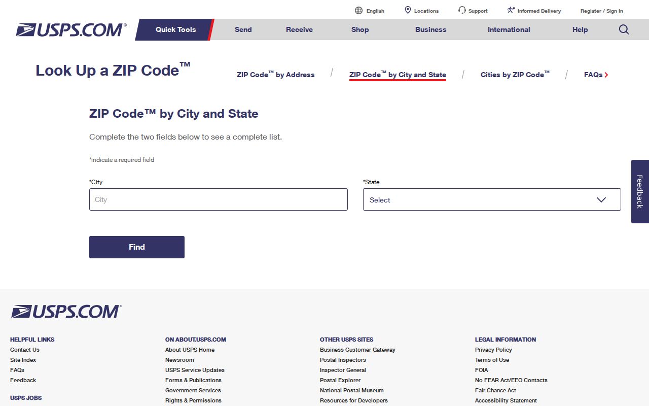
The captured USPS screen supports the Imperial city and state pairing used for 92251. It does not draw the city limit, sphere of influence, parcel line, or carrier route. It also does not settle whether a particular delivery is a PO-box service, a street delivery, or part of a postal route that reaches beyond the incorporated city. Keep the USPS result as postal evidence, then use a city or county source for jurisdiction and land records.
When a result is unclear, repeat the search with the full street number, street name, unit information when needed, city, and state. Do not substitute a neighborhood label for the postal city. A dated USPS check gives later users a way to see whether the postal result or the underlying address record changed.
Note: USPS confirms address usage, while Imperial's zoning map supplies the separate city-limit and sphere-of-influence context.
Search Imperial by ZIP
A ZIP code directory search is a sequence of checks, not one countywide resident roll. The assessor's public tools accept a physical address or APN, not an owner-name internet query, and the research did not verify a ZIP filter in that system. The voter-status tool is a self-lookup, not a street or ZIP browse. Start with postal validation, then carry the address or parcel key into the custodian that holds the record.
- Run the complete address through USPS and record the returned ZIP, postal city, and the date checked. For incorporated Imperial, compare the result with the confirmed 92251 claim.
- Enter the physical address or APN in the Imperial County Assessor Property Value Notification tool or use ParcelQuest Lite after its external-host notice. Do not expect a name search.
- Use the Assessor Front Desk Geo Viewer or City GIS Services for parcel and street context. Click or pan to a parcel, capture its APN, and do not assume a ZIP layer is present.
- Use the Imperial County tax search when a parcel or bill key is the right path. A tax result is tied to a parcel and bill, not a list of every person at a postal address.
- Use My Voter Status only for the person who can supply the matching identifiers. A broader voter-file request goes to the Imperial Registrar and must state a permitted purpose and beneficiary.
- For a retained city record, send a focused CPRA request naming the address, APN, record series, and date span. Ask for an existing record, not a new ZIP directory.
Once the postal and parcel checks narrow the work to a street, the Imperial by-street address directory supplies the street-level record sequence. It is the better next stop for adjacent parcels, recorded parties, and address-specific permits.
Imperial ZIP Records by APN
The APN is the bridge between postal geography and county property records. Imperial County's public assessment workflow starts with the physical address or parcel identification number. A result can expose an assessment number, situs or physical address, assessment components, and basic parcel characteristics, depending on the linked product. It does not provide a public owner-name search. That limit matters when a ZIP directory search begins with a person rather than a known address.
| Field or control | Type | Required | Format or result note |
|---|---|---|---|
| APN / Parcel Identification Number | Text | One search key | Use the county's exact parcel format when known; it is a unique parcel key |
| Physical address | Text | One search key | Enter street number and name; suffix or unit details may need checking |
| Owner name | Unavailable in the county public internet search | Not applicable | Use address or APN, then the recorder index for indexed party roles |
| Submit and assessment number | Button and result link | Not applicable | Submit, then open the underlined assessment number to view the notice |
The Assessor counter is in Suite 115 in El Centro and is open weekdays from 9 a.m. to 5 p.m. The office lists separate lines for mapping and GIS, transfers, building records and mailing-address changes, residential value, and exemptions. Those phone routes and assessor@co.imperial.ca.us are useful when an address needs parcel help. An in-person visit or a focused CPRA request can address a retained roll extract, subject to redaction rules. Date any value notice because the public site warns that displayed assessed values are as of January 1, 2022.
Imperial ZIP and City Limits
A postal city and an incorporated city are different kinds of geography. The 2023 Imperial zoning map marks the city limits, a larger sphere of influence, streets, zoning, and development context. The ZIP directory cannot replace that map. Research did not find a published polygon that proves where 92251 stops, so it is not safe to list every outlying address or claim that a city-line mismatch follows a named subdivision.
Postal is not jurisdiction. Use USPS to verify the delivery ZIP, then use the zoning map or a county parcel source to determine whether the address sits inside Imperial, within the sphere, or outside both. Keep those findings in separate fields.
The map labels Barioni Lakes, Encanto Estates, Springfield, Morningside, McFarland Ranch, and Sanchez Ranch as planning or development geography. Those labels help locate a street, but they are not proof of an active association, a postal boundary, or a complete list of homes. Annexation and subdivision records, including Municipal Code chapters 5 and 20, are the better sources for change history. No dated street-renaming list or numbering rule was verified.
Imperial ZIP Records: Situs and Legal Description
Three address forms must stay distinct. Situs is the land or building being assessed. A mailing address is where tax or other correspondence is sent. A legal description identifies the land by subdivision, lot, block, survey, or another recorded description. The ZIP label usually belongs to the mailing layer. The APN ties the map and assessment layers together, while a deed ties a party to a legal parcel and recording event.
A notice sent to a different mailing address may show an absentee taxpayer, but it does not prove where that person lives. A property owner may not be the occupant, and a current address result does not establish that every household member uses the same postal label. When a street name, number, or unit changed, preserve the legal description and APN beside the old and new address forms. That record trail is stronger than a ZIP-only match.
The county assessor and tax search are useful for the parcel stage. RecorderWorks is the next office when a deed, lien, map, or other recorded document is needed. The recorder's online index begins January 2, 1986; older indexes are held at the Clerk-Recorder counter. A ZIP directory can point to the right parcel, but the custodian's index and underlying document must answer title or party questions.
Imperial ZIP Map Labels Need Care
Imperial's numbered and lettered core sits beside newer curving streets shown on the zoning map. That visual pattern can make a map label feel like a neighborhood boundary, yet the research supports only a map-reading use. Barioni Lakes, Encanto Estates, Springfield, Morningside, McFarland Ranch, and Sanchez Ranch are named development or planning labels in the local geography. They are not verified postal districts and do not create a public neighborhood roster.
This distinction also prevents a common research error. A person may ask for every resident in a named development, while the available county tools return one address or APN at a time and the elections system does not allow casual street browsing. A careful postal directory records the label as context, checks the postal address with USPS, and then names the exact record office needed for a parcel, permit, voter status, or historic source.
Postal Terms for Imperial Searches
Postal terms often sound like land-record terms. They are not interchangeable. These short definitions keep a postal search from making a claim the source cannot support.
- ZIP code
- The five-digit USPS delivery geography used to sort mail. It is not a city-limit, parcel, voter, or household boundary.
- ZIP+4
- The extra four digits refine delivery within a five-digit ZIP code. They can point to a route segment or delivery point without changing city jurisdiction.
- PO-box ZIP
- A ZIP code assigned to post-office-box deliveries. The research did not verify a PO-box classification for 92251, so that status should not be guessed.
- Unique ZIP
- A ZIP code assigned to one organization or large facility. No unique ZIP was confirmed for Imperial in the available sources.
- Carrier route
- A USPS delivery-route grouping. It is not the same as a city line, sphere, parcel, or public resident list.
Imperial ZIP Research Gaps
The strongest confirmed ZIP code directory statement remains simple: 92251 is the ZIP verified for incorporated Imperial and for official city facilities. The available research does not establish a boundary polygon, a post-office station name, PO-box status, a split or realignment history, or a complete inventory of addresses where postal and city geography differ. It also does not publish an APN-format key, an E911 assignment office, or a dated list of street-number changes.
Those gaps change how a result should be written. Say that USPS verified the address usage. Say that the zoning map shows city limits and sphere. Say that the assessor accepts address or APN, while the public owner-name search is unavailable. Say that voter status is self-service and that broader file access is controlled. Do not invent neighborhood rows, promise a ZIP filter in a county portal, or treat a postal match as proof that someone lives at the address.
For a material record question, save the USPS result, parcel key, map date, and source URL, then ask the named custodian for the underlying record. That habit makes an honest ZIP code directory useful even where the public map ends.